- HOME
- OFFICIAL HISTORY OF HHLH&MS
- NEWS
- CONTACT
- THIS YEAR'S PROGRAMME
- MEMBERSHIP FEES
- OFFICIALS & COMMITTEE MEMBERS
- LIBRARY
- CAMBRIDGE LIBRARY SERVICES
- PHOTO GALLERY
- JOHN BUTEUX
- ELIZABETH BUTEUX
- SOCIETY NOTES 34 TO 40
- SOCIETY NOTES 41 TO 46
- SOCIETY NOTES 47- 55
- SOCIETY NOTES 56 -65
- SOCIETY NOTES 66-71
- SOCIETY NOTES 72-74
- SOCIETY NOTES 75 -78
- LOCAL HISTORY LINKS
- OUR FACEBOOK PAGE
- 19TH CENTURY OCCUPATIONS IN HEMEL
- 2ND LIEUTENANT REGINALD HERBERT SECRETAN
- DR. DAVID NEAL'S TALK 25 NOV. 2015
- EDWIN TROWELL - A MOST UNUSUAL LOCAL MAN
- LEVERSTOCK GREEN'S HISTORY & VILLAGE SIGN
- ROMAN ARCHAEOLOGY FINDS AT MAYLANDS GATEWAY SITE 2017
- STREET NAME PROJECT
- WW1 ARMISTICE CENTENARY
- PETER WARD, AN APPRECIATION
- LOCKDOWN DURING WWII
- BRITISH LIBRARY DIGITAL ARCHIVE
- CHANGES IN SECONDARY SCHOOLING
- STELLA CHANDLER
- SOCIETY NOTES 79-85

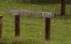
THE HEMEL HEMPSTEAD STREET NAME PROJECT
THE ROAD AND PLACE NAMES OF HEMEL HEMPSTEAD
Mike Stanyon, then Dacorum Heritage Officer, rose during one of the Society’s monthly meetings to ask a question that has since given rise to a g
reat deal of heartache and headache, but above all a sense of achievement in a project that is still in development.
The question was whether there were any members who would be interested in taking on the task of identifying the road names of the Town, and their derivations. Two or three tentative hands were raised and there began, dare it be said, the journey down the road towards piecing together the road names of Hemel Hempstead, and the reasons for their being named as they are.
The project, as I have said continues to this day, and is around 85% of the way towards completion. However, this will probably never be a complete exercise, because the Council in their wisdom insist on blatantly building more and more roads!
The journey thus far has taken us on a remarkable journey through Tithe Maps, Heavenly bodies, Rivers, other New towns, Literature, History, World wars, Town history, the Town Council, Mayors & Aldermen, Family history, and even Murder!
From the original project has sprung a secondary project, this one looking at the old names of the Town, and trying to find out where they came from as well. Such wonderful names as Rabbit Hutch Row, Cut off Head Lane, Chimney Pot Lane and Moses Amos’ Bottom, all come readily to mind.
It is a fascinating subject that has provided a great deal of interest for those who have been involved along the way, and with a local publisher awaiting the finished article for possible publication, it is something well worth seeing through to the bitter end.
If there are any other members out there who would be interested in helping out please do come forward, extra hands are always welcome.
Please also let us know if there are specific area’s you are interested in, be it your own road name, the name of an area of the town, or a name you have heard of and would like to know more about.
In closing, it would be of enormous help, with the older names in particular, if you have any old road maps you would like to donate or old maps that we could perhaps copy and return.
If you can help in any way please contact either Roy or Margaret Wood on HH398285, or e-mail Roy at roy.wood3@ntlworld.com
~~~~~~~~~~~~~~~~~~~~~~~~~~~~~~~~~~~~~~~~~
JUST A SMALL SAMPLE:
Box Lane: Dates back to Roman times. The remains of two Roman cremation burials were found in Box Lane Chapel (now converted into a private residence) in 1837. Open field area maps of 1523 show Boxhill as a name in the area in 1523. The Chapel itself was officially founded in 1668, but there is a local legend that Oliver Cromwell once took communion there on returning from the Battle of Marston Moor.
Brackens: Probably just given the name after the plant by the developer, but we are trying to find out more.
Brambling Rise: The brambling is a bird, a member of the finch family. They normally arrive in this country from the end of September to middle of November. And leave in the spring. It may have been this was an area they came to.
Branksome Close: This was built on land that was part of the Hobletts Estate, but as yet we have no info on the name itself.